|
|
Post by e on Jan 3, 2008 9:53:00 GMT 8
would anyone suggest a good route across the islands from north to south? thanks
|
|
|
|
Post by arcireyes on Jan 3, 2008 10:32:55 GMT 8
are you serious?
|
|
|
|
Post by kulot_salot on Jan 3, 2008 10:59:40 GMT 8
from basco, batanes you need to hop on a boat or a plane to reach luzon mainland... ilocos norte or cagayan... then from there your option is to take the cordillera circuit from cagayan or cervantez in ilocos sur going to sagada... then to baguio or go towards nueva vizcaya... if your like the west side... go towards pangasinan and down to zambales connecting you to bataan, pampanga, bulacan & manila via mcarthur hiway... if from from nueva vizcaya... go towards bulacan... when you hit bulacan... go towards the trail of norzagaray to rizal... then continue down towards infanta then bicol... then hit the ferries towards the visayas & mindao... can't say more... what i know is from sorsogon to masbate to sibuyan to tablas to marinduque to mindoro then back to luzon island... and back to my bed in manila....  |
|
|
|
Post by e on Jan 3, 2008 11:25:03 GMT 8
hi arci. plan is to fly into basco. ride around until the next available boat/ship ride to aparri (is there a ride to aparri), then, ride the western coastline to manila, take a shower at home in q.c.
then proceed to batangas port (via the SRNH) that leads to calapan, roxas, caticlan, calibo. iloilo, dumaguete, dapitan, zamboanga, basilan, jolo, tawi-tawi
or from q.c. ride straight to sorsogon, samar, tacloban. leyte, surigao, agusan, misamis, cagayan de oro, iligan, lanao, zamboangga, basilan, jolo, tawi-tawi
whichever of the two routes will be taken, the next route plans to span the palawan island via zamboangga city (is there a boat/ship ride from mindanao to puerto princesa?) or should the route be better if from tawi-tawi, just ride a banca to borneo and bike accross the island towards the southern tip of palawan?
when on palawan, plan is to ride northward then ride the banca to occidental mindoro towards calapan and connect to batangas then ride back home in q.c.
any suggestions pls on a better route? if it was you doing the cross-country bike, what islands would you opt to hop.
bike route plans are underway and all suggestions are very much appreciated.
many thanks to PinoyMTBiker and its members for the free travel consultation in advance.
the solo biker will definitely update his progress during his entire 1st ultra endurance bike of his life.
May the Holy Spirit keep him safe, alive and well.
thanks.
|
|
|
|
Post by e on Jan 3, 2008 11:31:44 GMT 8
from basco, batanes you need to hop on a boat or a plane to reach luzon mainland... ilocos norte or cagayan... then from there your option is to take the cordillera circuit from cagayan or cervantez in ilocos sur going to sagada... then to baguio or go towards nueva vizcaya... if your like the west side... go towards pangasinan and down to zambales connecting you to bataan, pampanga, bulacan & manila via mcarthur hiway... if from from nueva vizcaya... go towards bulacan... when you hit bulacan... go towards the trail of norzagaray to rizal... then continue down towards infanta then bicol... then hit the ferries towards the visayas & mindao... can't say more... what i know is from sorsogon to masbate to sibuyan to tablas to marinduque to mindoro then back to luzon island... and back to my bed in manila.... Hi kulot_salot, the luzon northern trail down infanta-bicol seems a very good alternative southward bound. would others give me a vote on why the route from basco should drive towards the pacific coastline or the china sea coastline? many thanks again guys and gals :-) |
|
|
|
Post by e on Jan 3, 2008 11:36:35 GMT 8
i forgot to ask the PinoyMTBiker and its members... Has any Filipino done a one-way end-to-end traverse of this route or has any Filipino done a complete double-traverse of the archipelago?
|
|
|
|
Post by kulot_salot on Jan 3, 2008 11:41:00 GMT 8
heard and still unconfirmed....  a monster-moderator will do a north to south ride this 2008.... |
|
|
|
Post by kulot_salot on Jan 3, 2008 11:44:54 GMT 8
would others give me a vote on why the route from basco should drive towards the pacific coastline or the china sea coastline? it's because it's the most scenic route you can do... to the west is the zambales mountain range & to the east is the great sierra madre.... in the middle of it all is just plains.... just plains.... literally.... i suggest you do the cordillera circuit then 'toss-coin' if to go west or east... |
|
|
|
Post by e on Jan 3, 2008 11:46:13 GMT 8
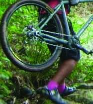
the downhill bike with fat road tires (the same bike to be used in this basco to bonggao traverse) has been assembled and has been test ridden for fine tuning from q.c. to general nakar via a combination of road and off-road from q.c. via maarat to boso-boso to sampalok tanay to c-5 towards llavac (hard terrain, rider had to change tires from road to intense's full knobby ) down to real and up infanta then general nakar.
i will post the picture of the bike today.
Should the rider have a extra bike with his back-up 4-wheel drive or should he just ride the entire lenght on his own? your suggestions are very much appreciated. many thanks again.
|
|
|
|
Post by e on Jan 3, 2008 11:51:07 GMT 8
the rider is a few days away from his flight off basco batanes. just hearing/reading out what the PinoyMTBiker and its members have to say and suggest re the route options.
|
|
|
|
Post by arcireyes on Jan 3, 2008 12:37:44 GMT 8
hi jezz, so you're really serious  my advise is this: P M T B groups are scattered here and there around the archipelago, i.e. we have the PIDALEM of Ilocos, the group of angelobryant in the NE aurora area, of course the group of michael if you'll pass by the pampanga, angeles area, tapos down south is the BMB of batangas, the group of RQC88 in mindoro, the active group of iloilo mtbikers wiill surely be of help and in mindanao are different groups here and there na P M T B members. FR. Picx who have done numerous inter-island solo traverse will also be of good help. check the luzon, visayas, mindanao trails section and pick-up persons and PM them for info. HTH and good luck, ride safe |
|
|
|
Post by arcireyes on Jan 3, 2008 12:44:26 GMT 8
and if i may add pala, KRAM did a solo ride QC-DAVAO (??) yata sometime this year. heard that KRAM is now based somewhere in bacolod yata, i'm sure he'll be a good source of information too. his solo ride thread yata is still posted eh paki-search na lang.
HTH-2
|
|
|
|
Post by anthrax76 on Jan 3, 2008 13:42:19 GMT 8
yeah, try to contact Fr. Picx. check his intro in the boards, he's done a south - north - south.
good luck on your epic ride brad. if you have a backup vehicle, that would be best. but if you want to ride it out solo, i suggest a touring bike or have panniers (but that might not be a good idea if you have an FS).
just a suggestion, take the pangasinan route, go west side. i'm not sure you'll get good support on the east side in case you run into something.
just my 0.02
|
|
okidok
Bike Commuter
 MiniMe
Posts: 67
|
Post by okidok on Jan 3, 2008 14:09:28 GMT 8
Are you the rider Dale? You can do it, keep us updated along the way.
I think the downhill bike is a bit heavy for a crosscountry run. my 2 cents anyway.
|
|
|
|
Post by e on Jan 3, 2008 14:35:18 GMT 8
so nobody has done basco-bonggao yet? its one of the 2 main reasons why i am doing it besides the scenery, the friends and the experience. the other main reason is its also for a worthwhile cause...
|
|
|
|
Post by e on Jan 3, 2008 14:37:05 GMT 8
i have yet to decide if i should do a double traverse but on a different route going back to q.c. para more scenery and more experience.
|
|
|
|
Post by e on Jan 3, 2008 14:43:10 GMT 8
Hi okidok, its a bike tour at a relaxed pace on a 10 hour a day basis. not sure how much kms i will average a day though... ive been saving money, building my ideal bike (trial & error), training, route planning and getting psyched up for this trip for almost a year now...
|
|
markdc
Newbie
Construction Guy
Posts: 44
|
Post by markdc on Jan 4, 2008 9:08:54 GMT 8
So it is you Dale........wow! Another adventure for Mr. Adventure. Keep us posted, pati sa 4x4ph na din. Good Luck!
|
|
|
|
Post by Freeman on Jan 4, 2008 11:26:04 GMT 8
heard and still unconfirmed.... a monster-moderator will do a north to south ride this 2008.... I heard this also, but i think he's darn too weak now to pursue ;D eanother suggestion if your going via isabela province, there's a route from isabel to palanan, then from palanan straight to casiguran aurora, from casiguran going to baler, then baler to cabanatuan... from cabanatuan you could use the backroards of bulacan going to QC via san rafael, norzagaray and licao route ... that's 60-70% trail but i suggest you use an all mountain bike rather than a heavy DH rig good luck brad' |
|
|
|
Post by whoopi on Jan 4, 2008 16:18:50 GMT 8
good luck and be safe JEZZ! man, what a jaw-dropping adventure. heard and still unconfirmed.... a monster-moderator will do a north to south ride this 2008.... I heard this also, but i think he's darn too weak now to pursue ;D is that you PAUL? oh my. |
|
|
|
Post by e on Jan 4, 2008 21:40:33 GMT 8
hey freeman, i was contemplating on an entirely east coast (pacific side) route accross the entire sierra madre coastline/mountain range.
From Aparri there seems to be a 3rd class road that passes by santa ana, San Vicente, escarpada, matador, down bolos point, cabutunan, calanasan, valley point, baguio point, until the boundary of cagayan just before the map reaches thumb peak (1149mtrs), there seems to be a river that flows out of thumb peak and its already isabela.
then its seems the road ends at the boundary of cagayan and isabela. then an entire mountain range is without a road until the place called Palanan.
Does anybody know if there is a coastline trail that connects the end of isabela coastline to Palanan?
From Palanan, a 3rd class road appears hugging the pacific coastline until baler.
Next, does anybody know if there is a coastline trail that connects Baler to Dingalan?
From Dingalan, the trail leads to another dead end it seems at the boundary of aurora and quezon about 20kms before Deseda Point. The trail on the map ends for the 3rd time.
Question again is: does anybody know if the coastline is accessible by bike?
Because if i can connect to Ligaya or Prueba point, there seems to be a 3rd class road on the map that hugs the pacific coastline to General Nakar all the wat to Atimonan Quezon.
It seems to be the entire lenght of the Sierra Madre mountain Range from the map that i am looking at.
I have yet to examine a close look at the latest satellite picture at Google earth.
So i have 4 optional routes.
Its either i take the scenic and easy west coast and enjoy my ilocano kababayan's hospitality
or... take the national highway?
or the mountain trail via laoag,kalinga apayao, bontoc, benguet, baguio down manila
or the other mountain trail via laoag,kalinga apayao, bontoc, banaue, nueva viscaya, manila
or the entire pacific east coast?
Please inspire me my friends. i direly need all your comments so i can make my final decision soon. many thanks
|
|
|
|
Post by e on Jan 6, 2008 19:01:36 GMT 8
does any PinoyMTBiker Palawan member or any PinoyMTBiker Zamboangga member know of a plane or a commercial shipping that ply/fly Zamboangga-Palawan? And how much is the fare for a bike and a rider? many thanks
|
|
|
|
Post by e on Jan 6, 2008 19:21:09 GMT 8
i have more or less decided on my route. its basco to qc via the west coast and all the way down to
sorsogon-masbate-samar-surigao-butuan-agusan-davao-mt.apo summit-cotobato city-pagadian-zamboangga city-basilan-jolo sulu-tawi tawi
if there is no flight/ship from mindanao to palawan, i will opt to bike through borneo, then connect to palawan somehow.
my next problem if the inevitable happens is to somehow connect again back to zamboangga to ride through dipolog-misamis-iligan-cagayan de oro-bohol-cebu-negros-iloilo-antique-capiz-aklan-boracay beach?-romblon-mindoro-batangas-qc-home
if somehow i decide to do a complete double traverse, i will pass through viscaya, tuguegarao, aparri-ilocos-basco batanes-fly back to manila
kindly give me a constructive comment on my proposed route?
help on my miindanao-palawan dilemma? pleeeezzzz :-)
|
|
|
|
Post by blackknight on Jan 6, 2008 20:07:04 GMT 8
As far as i know there is no common carrier covering the mindanao-palawan route. Try Cebu-Puerto Princesa ( Cebu Pacific -3x a week) or Iloilo-Puerto Princesa ( Montenegro Shipping lines - weekly).
|
|
|
|
Post by e on Jan 6, 2008 21:59:37 GMT 8
great help blacknight many thanks now i can plan better
now i dont have to pass through borneo... saved me weeks of travel... what a relief...
|
|
|
|
Post by e on Jan 6, 2008 22:15:50 GMT 8
Hi okidok & freeman, the downhill bike i assembled already cost me a good fortune and i seem to be comfortable with the weight issue for ive done about 600kms on it as a warm up for my cross-country plans. my finances now would not recommend me assembling an all mountain set-up (wish i had more budget) because i might use the extra pocket money for other logistical emergencies along the way.
i gez the DH bike will be of good use when i go down from the summit mt. apo with it.
question is, has there been a well documented biker that has gone to the summit with a mountain bike?
2nd question. since it is a national park, will the local govt allow a mountain bike up there?
|
|
|
|
Post by e on Jan 6, 2008 22:20:16 GMT 8
anyway, ive posted on the trading section of PinoyMTBiker a small fundraiser for my pocket money. id appreciate if anyone can help me find a buyer for my used Stratus DH specific 8,1/2-inch travel monster-sized inverted fork. help meeeee? pleeezzzzz? thanks guys and gals ;D
|
|
|
|
Post by mountguitars on Jan 7, 2008 1:28:25 GMT 8
Hi okidok & freeman, the downhill bike i assembled already cost me a good fortune and i seem to be comfortable with the weight issue for ive done about 600kms on it as a warm up for my cross-country plans. my finances now would not recommend me assembling an all mountain set-up (wish i had more budget) because i might use the extra pocket money for other logistical emergencies along the way. i gez the DH bike will be of good use when i go down from the summit mt. apo with it. question is, has there been a well documented biker that has gone to the summit with a mountain bike? 2nd question. since it is a national park, will the local govt allow a mountain bike up there? wow, i guess you will be the first to do this not unless im mistaken. go e. |
|
|
|
Post by e on Jan 7, 2008 8:48:00 GMT 8
mga sirs & madams, alam ko meron na naka motorbike dun sa mt. apo summit pero meron na po ba nag dala nang mountain bike sa summit ng mt. apo?
i need po sana an official reply from PinoyMTBiker moderator/s before i attempt mt. apo summit, it would definitely interest me in knowing na mt. apo will have a biker & his bike (with PinoyMTBiker's support) up there for the first time. otherwise, i'd skip mt. apo in my route planning and save me about a week off my itinerary
|
|
|
|
Post by Freeman on Jan 7, 2008 19:22:03 GMT 8
mga sirs & madams, alam ko meron na naka motorbike dun sa mt. apo summit pero meron na po ba nag dala nang mountain bike sa summit ng mt. apo? i need po sana an official reply from PinoyMTBiker moderator/s before i attempt mt. apo summit, it would definitely interest me in knowing na mt. apo will have a biker & his bike (with PinoyMTBiker's support) up there for the first time. otherwise, i'd skip mt. apo in my route planning and save me about a week off my itinerary Hi e', sorry for the late reply, regarding baler-dingalan, i heard there's a trail/footpath there used by some motocross riders and natives before, been thinking of doing that route also, or you could hire a banca at baler to bring you to dingalan if the said trail don't exist.. re: Mt. Apo.. if i'm not mistaken i know a fellow biker here (avol of montalbikers) tried bringing a mountainbike up the summit using the venado route when he stayed in davao and worked as a guide there., siguro if you have contacts with DENR there they might allow you also.. and yes a dirtbike has reached mt apo's summit courtesy of mr. dale abenojar (right jaymz? ;D) |
|