Post by seacid on Aug 29, 2007 11:52:23 GMT 8
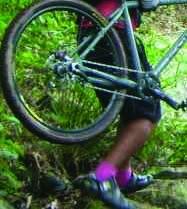
We are inviting the PinoyMTBiker community to a tree planting activity at Mt. Palaypa;ay in Cavite this Saturday, Sept 1, 2007 from 8am to 12 noon.
The Tree Planting in Mt. Palaypalay as part of the
Trees for Life : 20 million seedlings project of the Green Army. EcoRescue will be helping them out. Mt. Palaypalay /
Mataas na Gulod Protected Landscape is located within
the Municipalities of Maragondon and Ternate, Province
of Cavite and Municipalities of Nasugbu, Province of
Batangas. We will be planting at the Ternate side.
We will be planting a total 1,000 Camagong seedlings
to be planted in Mt. Palaypalay near the road so that
it will be accessible to the adoptors and thus making
possible the nurturing side.
There will just be a short program on trees and tree planting.
The plots will be made ready for planting
Please bring your water and food and maybe small
shovel/trowel and gloves Clothes for planting and just be ready for rain.
Best route I think is Coastal Road via Bacoor - Imus -
Dasmarinas - Gen Trias - Trece Martires City - Naic -
Maragondon - Ternate Proper. There is an alternative
South Expressway via Carmona exit - General Mariano
Alvarez (GMA) - Dasmarinas (Pala-pala)- Trece
Martires City - Naic - Maragondon - Ternate Proper.
Not sure how long the travel time is. I will going
there on Tuesday and will advise you.
Please let me know how many are going.
Thank you for helping us out.
Boy Siojo
EcoRescue
-----------------
The Mt. Palaypalay / Mataas na Gulod Protected Landscape is located
within the Municipalities of Maragondon and Ternate, Province of
Cavite and Municipalities of Nasugbu, Province of Batangas with
geographical coordinates of 14°12" North Latitude and 120°35" to
120°42 East Longitude.
Elevation of the area ranges from 20 meters to 648 meters above
sea level. Among the three (3) peaks namely: (1) Mataas na Gulod; (2)
Mts. Palay-palay and (3) Pico de Loro. The latter is the highest with
an elevation of 648 meters above sea level.
Biological Features
The area is characterized as rolling to moderately sloping in some
portion, steep to very Flora
The existing vegetation in the area is considered second growth forest
of molave-dipterocarp type. Other premium species that can found are
akle ( Serialbizia acle), molave (Vitex parviflora), kalingag
(Cinnamomum camphora) a known medicinal to cure stomach trouble or for
cleansing stomach.
Listed below are the dominant tree species found in the area, to wit:
Common Name Scientific Name
Kamagong Diospyrus philippinensis
White lauan Shorea contorta
Red lauan Shorea negrosensis
Guijo Shorea guijo
Pili Canaruim ovatum
Fauna
In 1995, the Professional Environmental Management Company (PEMC)
conducted study on the floral and faunal species in the area. The
group identified 123 species of wildlife; (76) birds; (21) reptiles;
(16) mammals and (10) amphibians inhabiting the park. Thirty one
percent (31%) of them are endangered or threatened as listed below:
Common Name Scientific Name
Philippine Falcon Microhiery erythroganys
Blue Nape Parrot or Loro Tanygnathus luzunicus
Rufous Hornbill or Kalaw Buceros hydrocorax
Philippine Woodland Frog Rana Magna
Other wildlife species found in the area include monkeys (macaca sp.),
wild pig ( sus barbatus), phyton (phyton reticularis), cobra locally
known as almoranin, alamid, monitor lizards, wild chicken and several
avifaunal species like bato-bato hawk, green parrot, tarikitik, bat,
owl, kingfisher, quail, maya and etc.
Special Features
The park has three (3) major peaks namely: Mts. Palay-palay, Mt.
Mataas na Gulod and Mt. Pico de Loro. The latter is the highest peak
with the height of 648.0 meter above sea level.
The inherent beauty and large size of the park provide the possibility
of giving a wide range benefit in terms of eco-tourism and
recreational activities. There is diverse flora and fauna ideal for
research/study and viewing (bird watching), with springs and rivers
ideal for bathing.
The most prestigious area is Mt. Pico de Loro which is the dream site
of mountain trekkers/hikers, mountaineers and other visitors of the
park.
Other amenities that can be enjoyed in the park are the following:
picnicking, nature tripping, camping and the likes.
Legal Basis
Mts. Palay-palay / Mataas na Gulod National Park was declared as
National Park by virtue of Presidential Proclamation No. 1594 dated
October 26, 1976. As initial components of NIPAS, It is categorized as
Protected Landscape and Seascape under Republic Act No. 7586 otherwise
known as NIPAS Act of 1992.
In June 2007 it was declared as Mt. Palaypalay / Mataas na Gulod
Protected Landscape
Source:
calabarzon.denr.gov.ph/real/PAsite/palaypalay.htm